- Home
- About
- Insurance
- Quote
- Dental/Health
- Service
- Notary
- News
- Referral Partners
- Agent Resources
Interested in Windstorm?
Get automatic alerts for this topic.

[ad_1]

ST. PETERSBURG, Fla. (AP) — The “cone of uncertainty” produced by the National Hurricane Center to forecast the location and ferocity of a tropical storm is getting an update this year to include predictions for inland areas, where wind and flooding are sometimes more treacherous than damage to the coasts.
The Miami-based hurricane center said Thursday on the X social media platform that the new, experimental forecast tool will be ready around Aug. 15, just before the traditional peak of the hurricane season that begins June 1.
“This experimental graphic will help better convey wind hazard risk inland in addition to coastal wind hazards,” the center said in the post.
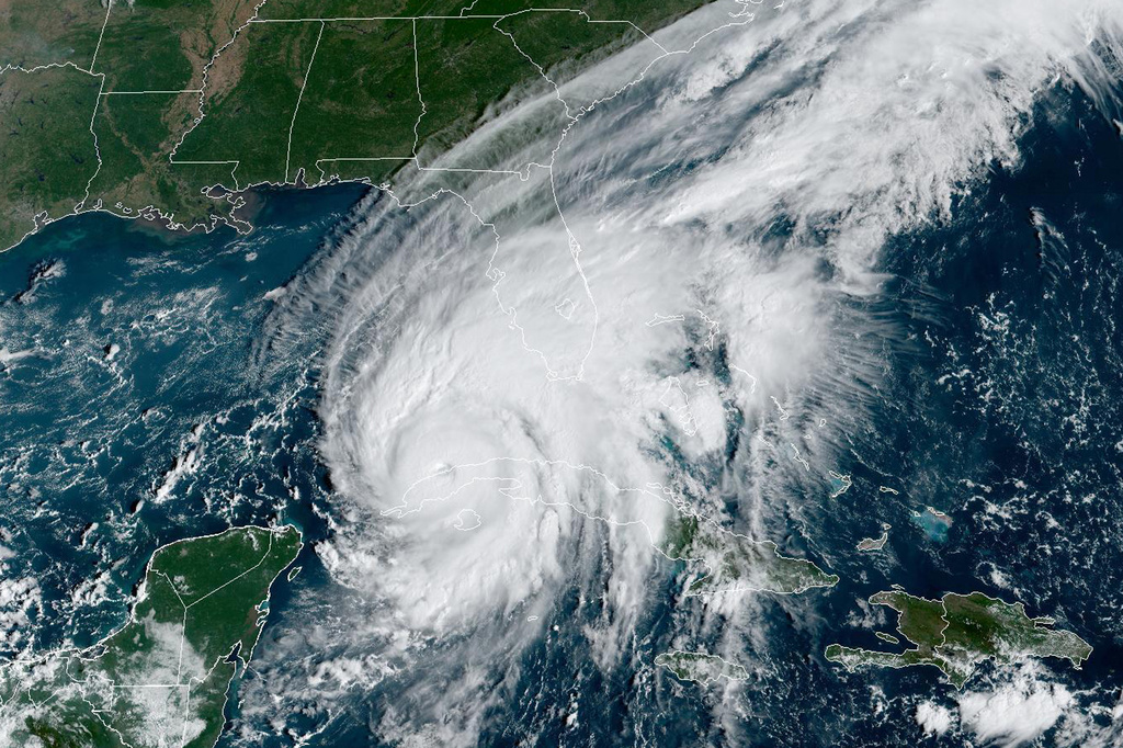
The traditional cone in use for years generally shows the forecast track of a hurricane or tropical storm but is focused on wind and storm surge along the coasts — and forecasters always warn not to focus on the center line alone. Heavy rains and strong winds can be deadly and cause significant damage inland, which happened in 2022 with Hurricane Ian, when 149 people died in Florida.
The goal of the expanded forecast cone is to make sure people who don’t live along a coast are aware of the dangers they could still face, said Jamie Rhome, deputy director of the hurricane center. The new cone features colors to show which places face threats in a much broader way than before. If someone lives in one of those areas, “you are under risk,” Rhome said.
There’s growing evidence that the impacts of climate change, such as rising sea levels, are making the most severe hurricanes even more intense and increasing the likelihood that a developing hurricane will rapidly intensify, leading to more flooding and more powerful storm surges battering coastlines, experts say.
After Ian blasted across the Fort Myers area — where the most people died and the worst damage was caused — the storm kept dumping rain and toppling trees across a wide swath of the state. Floods were reported around Orlando and its theme parks, south to Kissimmee, east to Daytona Beach, and in central Florida’s cattle and citrus country.
Ian produced between 10 and 20 inches (51 centimeters) of rain across much of central Florida, the hurricane center reported.
People near rivers were deeply and possibly unexpectedly affected. After Ian slogged through inland DeSoto County and the Peace River flooded the community, Fire Chief Chad Jorgensen urged residents to flee, saying the river was unpredictable and dangerous.
The first named storm of 2024 will be Alberto. The 2023 season saw 20 named storms, according to the National Oceanic and Atmospheric Administration, including seven hurricanes. Only Hurricane Idalia struck the U.S., coming ashore in the lightly-populated Big Bend region of Florida’s Gulf Coast but also causing significant inland flooding.
Photo: This GOES-East GeoColor satellite image taken at 9:56 a.m. EDT on Tuesday, Sept. 27, 2022, and provided by the National Oceanic and Atmospheric Administration (NOAA), shows Hurricane Ian passing over western Cuba. The familiar “cone of uncertainty” produced by the National Hurricane Center to forecast the location and ferocity of a tropical storm is getting an update this year to include predicted impacts in inland areas, where wind and flooding are sometimes more treacherous than damage to the coasts. (NOAA via AP, File)
Copyright 2024 Associated Press. All rights reserved. This material may not be published, broadcast, rewritten or redistributed.
Get automatic alerts for this topic.
[ad_2]
Source link
Comment (0)